


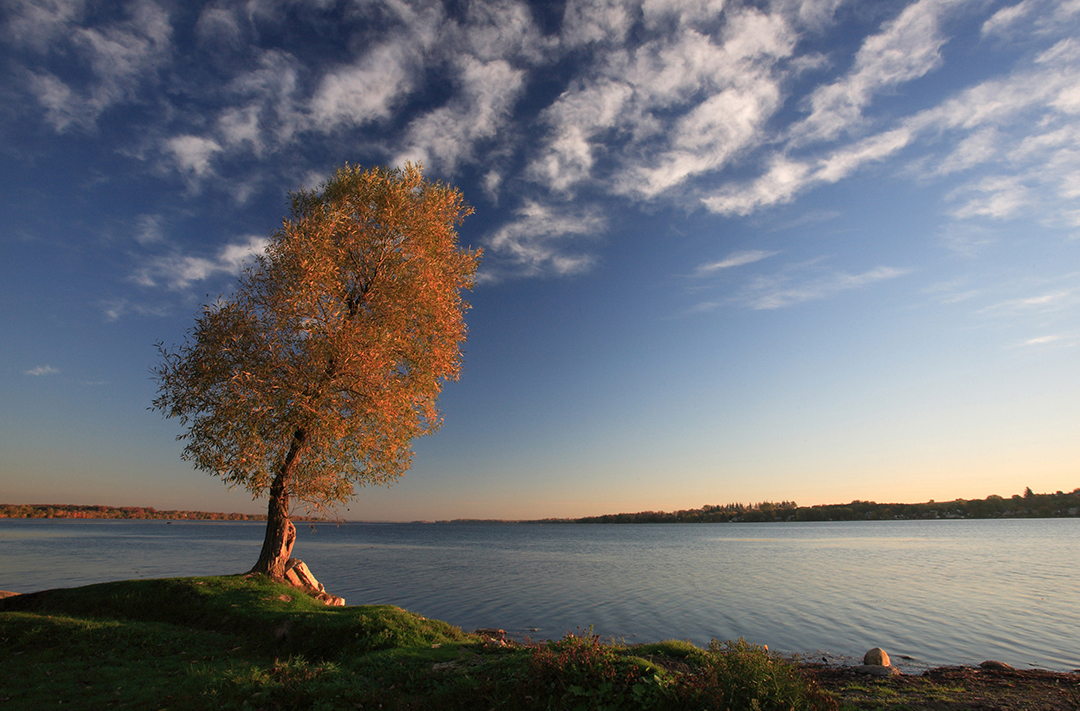
Over 12,000 years ago, during the Wisconsin glaciation in North America, the Oak Ridges Moraine (ORM) began its formation.
During the late Wisconsinan period, central Ontario was under thick ice. It is theorized that a large east-west fissure split the ice sheet at the western bounds of what would be the Oak Ridges Moraine, creating the Simcoe glacial lobe to the north and the Ontario glacial lobe to the south.
As the ice sheets began to melt and retreat, torrential flood channels would begin to develop under the ice carrying large accumulations of tills, layers of silt, sand and gravel and dumping them into the fissure forming the eventual ridge line of the ORM.
Today, the moraine spans around 160 km west-east from the Niagara Escarpment to the Trent River, covering over 470,000 acres of land. The moraine is up to 200 metres thick and rises over 300 metres above Lake Ontario.
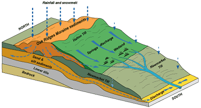
The Oak Ridges Moraine is an essential geological and hydrogeological landform for Ontarians.
“There are about 6 million people who reside, work or play within that geography of those 80 watersheds,” says Robert Messervey, chair of the Oak Ridges Moraine Foundation board of directors. “There are a quarter million people that derive their drinking water directly from the aquifers of the moraine.”
Messervey, a provincial representative on the Greenbelt Foundation board, has spent several decades working for various conservation authorities in Ontario and with the Ministry of Natural Resources.
Messervey says the moraine’s hydrological significance is that it acts as the watershed divide between Lake Ontario (south) and Lake Simcoe (north) and feeds more than 30 major waterways.
The ORM provides drinking water to Ontarians through its advanced ground water systems and aquifers. Precipitation is absorbed through the moraine’s highly permeable soil on the surface, which then filters through its layers of sand, gravel and clay and collects in a network of underground aquifers, a body of rock and/or sediment that holds groundwater.
These aquifers are where private and municipal wells draw water from, according to The Greenbelt Foundation website.
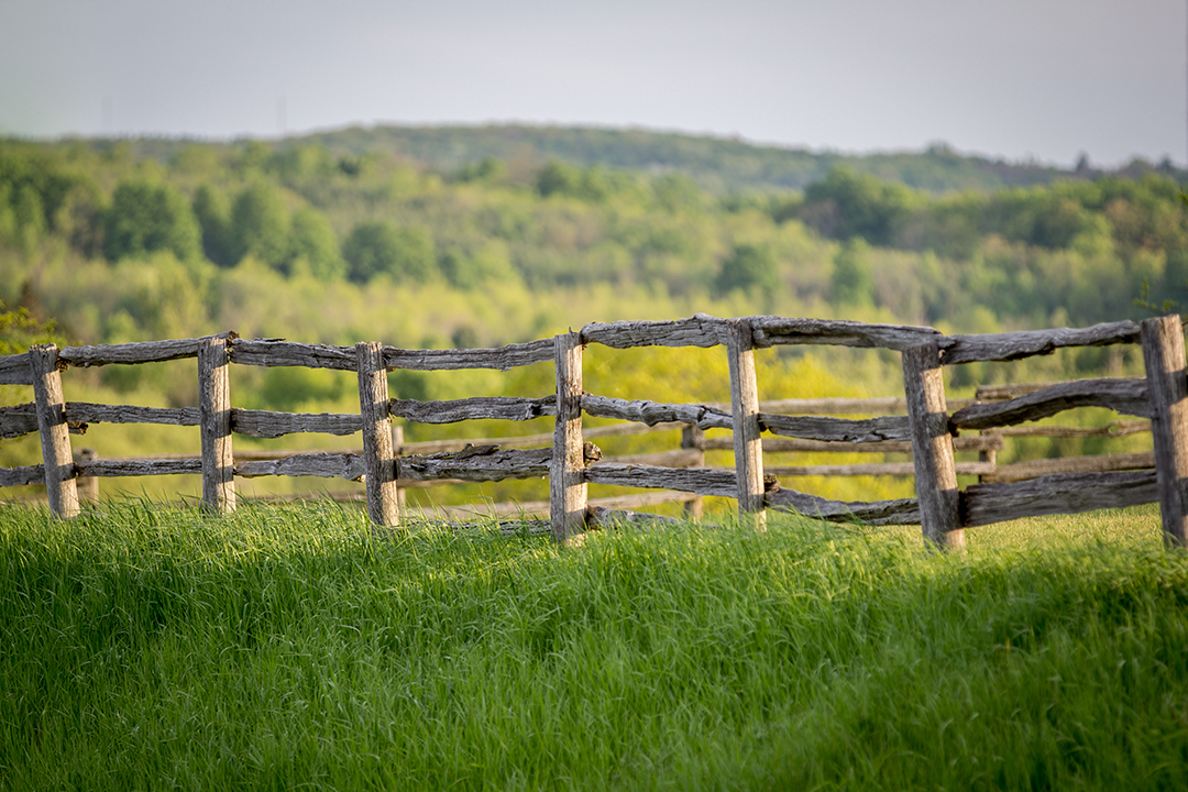
Along with the moraine’s key hydrological features, the ORM’s biodiversity is vast.
According to Oak Ridges Moraine Land Trust website, there are around 1,171 plant species, 51 mammal species, 73 fish species. The ORM is home to 88 provincial or national species at risk, just to name some of its enormous diversity.
Water that is not absorbed into the moraine’s deeper layers and aquifers, drains into over 80 watersheds and sub-watersheds in Ontario. A watershed is an area of land that water flows across or through on its way to a particular drainage basin, such as, creeks, streams, rivers and lakes.

A drainage divide, such as the Oak Ridges Moraine, is the elevated terrain that acts as the boundary of the individual watersheds, which can be as small as a few hectares to millions of square kilometres large.
“Everyone lives in one,” said Chris Jones, director of planning and regulation for Central Lake Ontario Conservation Authority (CLOCA).
CLOCA is responsible for 22 watersheds across Durham Region, such as the Oshawa Creek and the land that drains water into it.
Although there are regulations enforced by CLOCA and other environmental organizations, like the Ontario Ministry of Environment, on what can be developed near these environmentally sensitive spaces, issues and new challenges are always present.
The threat of human impact on the Oak Ridges Moraine has long existed. Whether it was the first European settlements, deforestation in the ’30s and ’40s for agricultural practices, or more recently with land in close proximity to known aquifers being used for large fill sites, such as the fill site run by Hard-Co Construction on 618 Columbus Rd. E., from 2008 to 2016.
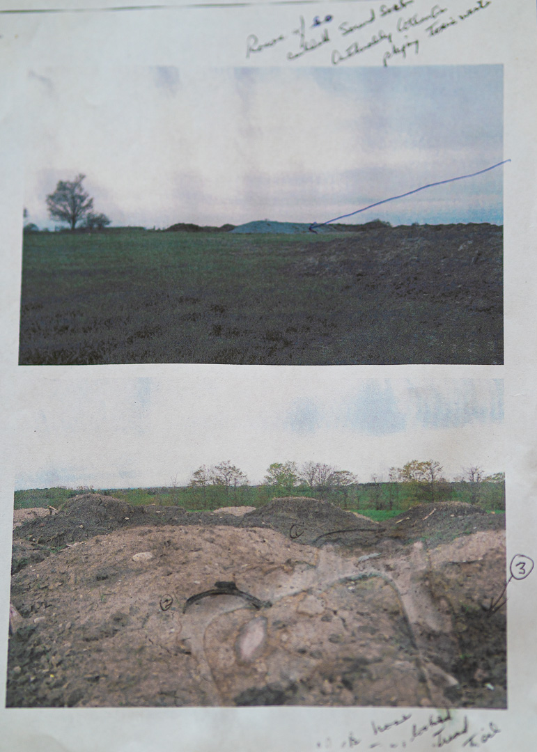
The site was found by residents to have potentially contaminating materials being dumped at the site.
The same company is currently in the process of applying for 140 acres fill site on Wilson Road North in north Oshawa, less than a kilometre away from the previous site and in close proximity to the Oshawa Creek watershed which flows south to Lake Ontario.
Several Ritson Road North residents within a kilometre distance of the previous Columbus site developed cancer following the opening and closing of the site. Some residents believe the cancer cluster may be due to potential soil contamination at the site which found its way into residents well water derived from aquifers of the ORM.

Councillor John Neal, who represents north Oshawa in Ward One, says the municipal and regional governments need to ensure it follows and enforces its environmental and strategic plans and policies for the protection of all residents’ health in the region, especially rural homeowners.
“If you’re going start using a site, then it’s up to that entity or whoever wants to use that property for a site… it’s incumbent upon them to work with the ones that test waters, the ones that test wells, it’s not up to the residents to control pollution,” says Neal.
Currently, there are a number of policies, acts and regulations in place to conserve the Oak Ridges Moraine and its watersheds. The Oak Ridges Conservation act, founded in 2001 and an updated plan released in 2017 by the Ontario Ministry of Environment, is an ecologically-based plan that provides land use and resource management direction for 190,000 acres of land and water within the moraine.
Local environmental agencies and organizations such as CLOCA and the 35 other conservation authorities in Ontario, follow these plans and regulations when monitoring watersheds in their jurisdiction, the conservation authorities can enforce these regulations if found to be broken, says Jones, who has worked for CLOCA since 2015.
Still… the rules aren’t always followed.
The Greater Golden Horseshoe is one of the fastest growing areas in North America, it extends from the Region of Niagara in the west to Northumberland County in the east. It is currently home to around nine million people and is expected to reach 13.5 million by 2041.
The population growth expected over the coming decades has put pressure on many regions and municipalities to focus on new development.
With new development being a must in these fast-growing areas, Messervey says it is essential that governments prioritize safe and eco-friendly development.
“Municipalities need to ensure that development proceeds in a sound way based on the requirements, protection mechanisms in the Oak Ridges Moraine Conservation Act and their own official plans and bylaws,” says Messervey.
The protection of Ontario’s environment and the vital Oak Ridges Moraine should concern every citizen living in the province. Messervey says there are a number of key areas where the Greenbelt Foundation and Oak Ridges Moraine Foundation are focused on enhancing in the future.
“Land stewardship, science and research, education and promoting awareness, supporting the Oak Ridge Moraine Trails, which needs some enhancements… there’s always lots of maintenance and signage and infrastructure that goes along with that. And then land securement,” says Messervey.
“So those are most of the key areas that I guess I would offer as areas of focus and priority going forward.”
As communities grow and climate change continues to alter seasonal and environmental conditions, citizens need to care and think critically about their environment and their local governments actions.
Jones suggests people who are concerned about their community’s environmental health, do their own research and reading and are encouraged to visit their local conservation authority’s website for information on their local watershed.
Neal says community members should also hold their local governments accountable for decisions that risk impacting citizens health or the environment.
“The best thing to do is to phone to write letters into the newspapers and when journalists are asking questions to the municipality or to any of the residents, to make sure all the data is available.”